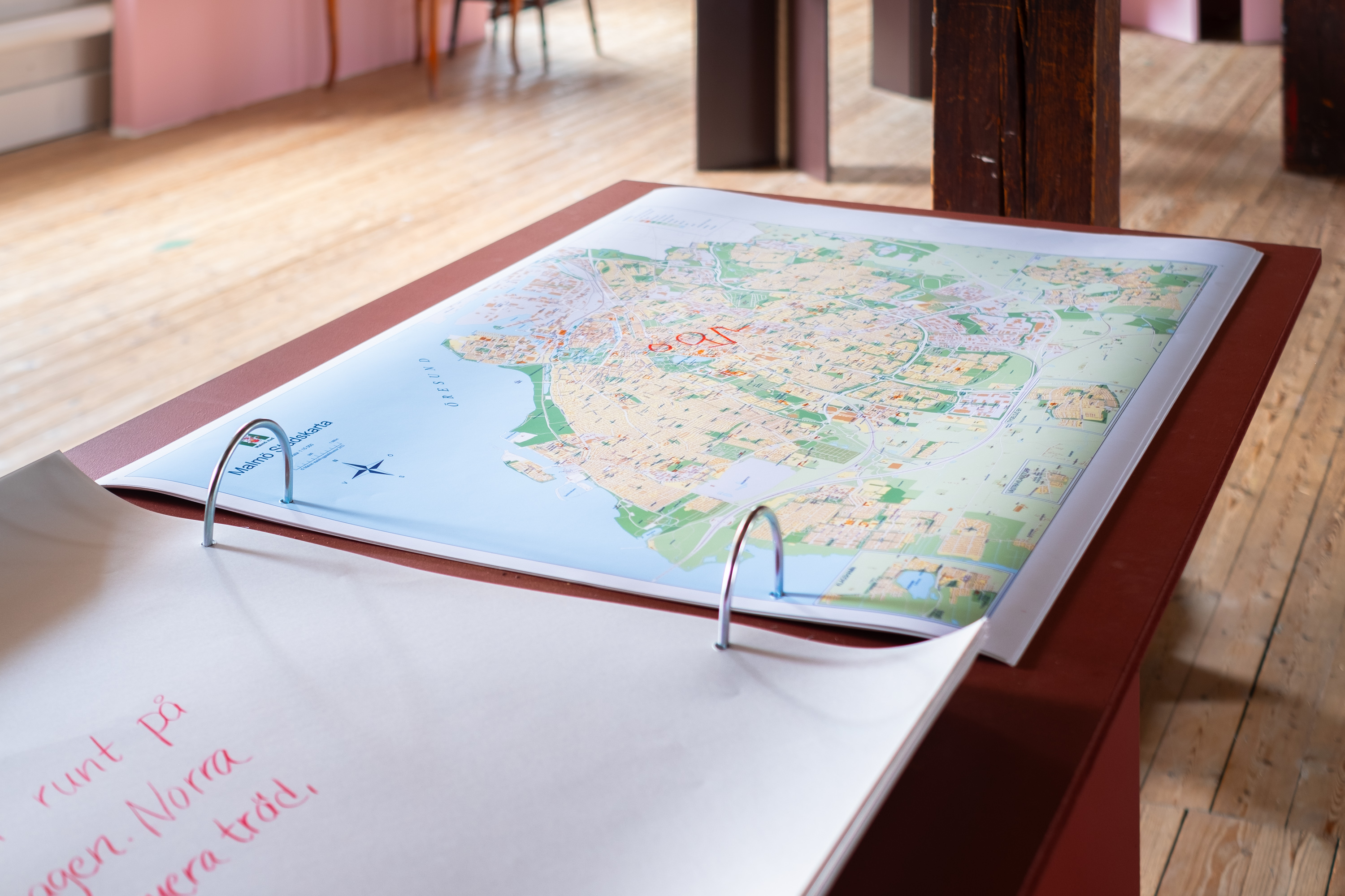
Malmö-Lund-Staffanstorp - Sketches of pathways and public land by planners
Interviews, maps. Karin Grundström och Mathilda Rosengren, 2021.
.
The majority of the publicly accessible land in our region is developed through planning. In order to find out more about which commons and pathways that are planned, and which ones that are considered important, about twenty urban planners were interviewed in the municipalities of Lund, Staffanstorp and Malmö. The planners were asked to sketch important routes and publicly accessible land on maps. The maps are a visual compilation of places that clearly figure in the planners’ imaginations and in ongoing planning procedures. The red lines show existing paths and commons, while the dotted lines indicate intended or potential ones.
.
.
Enskifteshagen (Malmö) - Sketches of pathways and commons by the public
Interviews, maps. Karin Grundström, Mathilda Rosengren, Cecilia Wendt & Edith Grundström 2021.
.
.
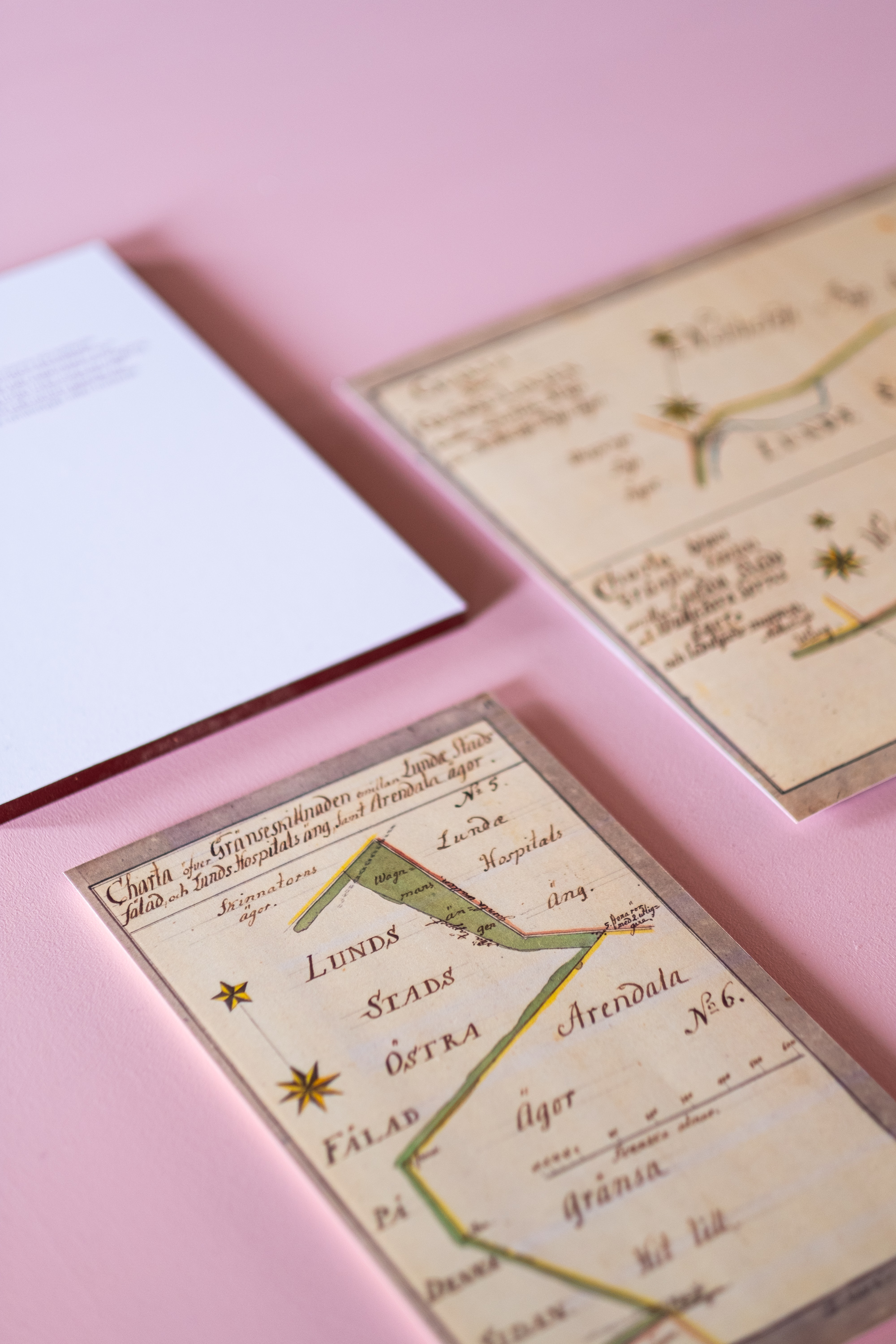
Lund - Historical maps of commons
1704 Ownership description 12–LUS–3. Archives of The Land Survey Authorities.
.
Around cities and villages there were commons in the form of pastures, so-called fälader, intended for grazing cattle, horses, and pigs. The map of Lund from 1704 shows how the pasture grounds (in yellow) expand outside the city centre. In addition to the street grid inside the city limits, the map also shows alternative thoroughfares such as “rough trails” (so-called rågångar) and fairways that criss-cross the pastures.
.

Malmö-Lund-Staffanstorp - Sketches of pathways and public land by planners
Interviews, maps. Karin Grundström och Mathilda Rosengren, 2021.
.
The majority of the publicly accessible land in our region is developed through planning. In order to find out more about which commons and pathways that are planned, and which ones that are considered important, about twenty urban planners were interviewed in the municipalities of Lund, Staffanstorp and Malmö. The planners were asked to sketch important routes and publicly accessible land on maps. The maps are a visual compilation of places that clearly figure in the planners’ imaginations and in ongoing planning procedures. The red lines show existing paths and commons, while the dotted lines indicate intended or potential ones.
.
.
Enskifteshagen (Malmö) - Sketches of pathways and commons by the public
Interviews, maps. Karin Grundström, Mathilda Rosengren, Cecilia Wendt & Edith Grundström 2021.
.
.
Lund - Historical maps of commons
1704 Ownership description 12–LUS–3. Archives of The Land Survey Authorities.
.
Around cities and villages there were commons in the form of pastures, so-called fälader, intended for grazing cattle, horses, and pigs. The map of Lund from 1704 shows how the pasture grounds (in yellow) expand outside the city centre. In addition to the street grid inside the city limits, the map also shows alternative thoroughfares such as “rough trails” (so-called rågångar) and fairways that criss-cross the pastures.
.